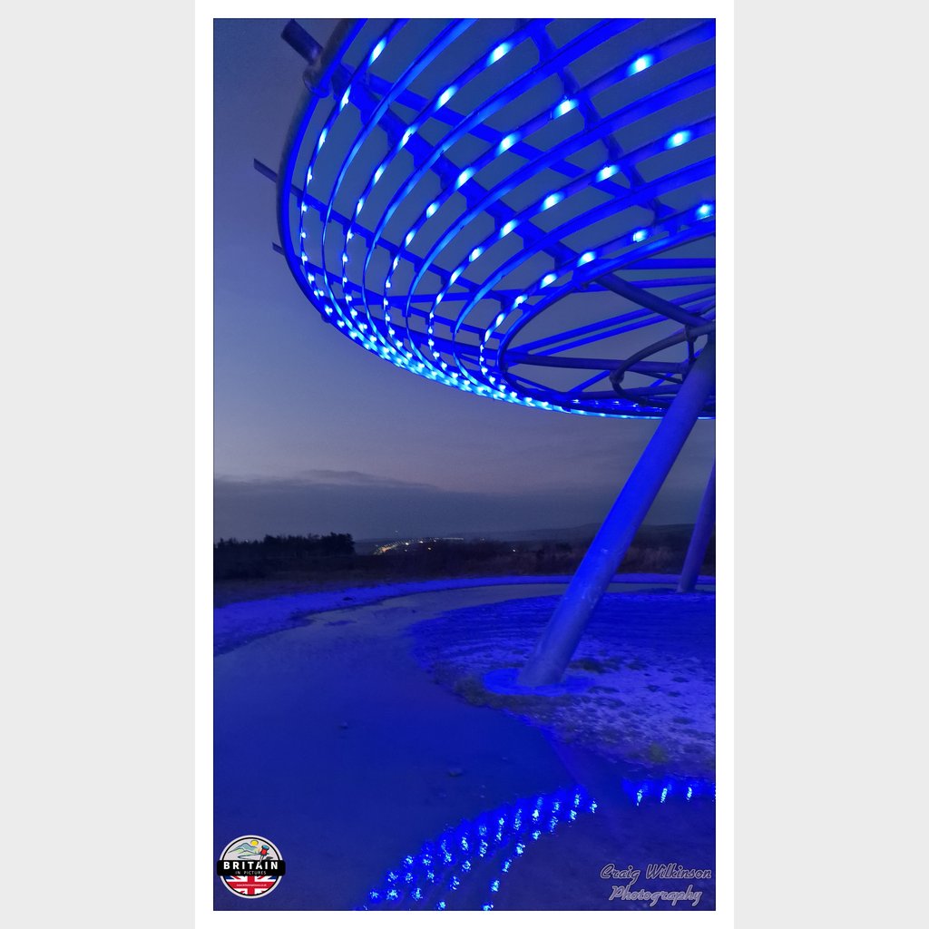
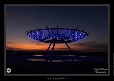
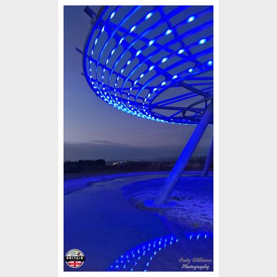
Halo
Sun & Moon Positions
Sun and moon directions from your standing position
—
—
Milky Way
Kp 3.340.0 nT
Sun and moon lines start from the blue person (your standing point). Orange camera = photo location. Unlock the padlock, then drag the person or camera—or tap the map—to adjust positions (not saved).
Photography Planning
What3Words
Add an API key in Admin → API Keys to enable.
EXIF Data
0 photos with camera metadata
Location Details
- Address: Rossendale, Lancashire, GB
- Latitude / Longitude: 53.7086602, -2.3170474
- Grid Ref: SD7916923628
-
Added by:
 Craig
Craig
Drone restrictions
- Log in to see flight restriction zones for this location.
Tidal location
Loading tide times…
View Statistics
- Total views71
- Today4
- This week15
- This month71
Nearby Locations
- Singing Ringing Tree 4.9 mi
- Lead Mine Clough Waterfall 10.8 mi
- Tigers Clough Waterfall 11.4 mi
- Gibson Mill 11.9 mi
- Roach Bridge 12.6 mi
Location Comment / Info (0)
Log in as a member to post a comment.
No comments or info yet.