
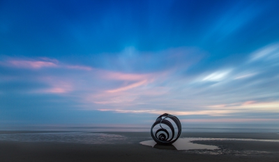
Marys Shell
Legacy location #8.
Photos at this Location
Sun & Moon Positions
Sun and moon directions from your standing position
—
—
Milky Way
Kp 1.016.4 nT
Sun and moon lines start from the blue person (your standing point). Orange camera = photo location. Unlock the padlock, then drag the person or camera—or tap the map—to adjust positions (not saved).
Photography Planning
What3Words
///column.remover.beginning
EXIF Data
2 photos with camera metadata
Photo EXIF Data
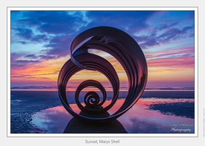
Sunset, Marys Shell
Camera: Canon EOS 5D Mark III
Date taken: 2019:10:06 13:39:03
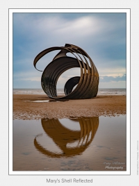
Marys Shell Reflected
Camera: Canon EOS 5D Mark III
Date taken: 2018:04:07 21:56:20
Location Details
- Address: —
- Latitude / Longitude: 53.884083, -3.047991
- Grid Ref: SD3121143608
- What3Words: ///column.remover.beginning
-
Added by:
 Craig
Craig
Drone restrictions
- Log in to see flight restriction zones for this location.
Tidal location
Loading tide times…
View Statistics
- Total views40
- Today3
- This week12
- This month40
Nearby Locations
- Fleetwood Shipwrecks 2.7 mi
- Blackpool Tower 4.8 mi
- Plover Scar Lighthouse 9.5 mi
- Lytham Jetty 11.0 mi
- Walney Lighthouse 12.5 mi
Location Comment / Info (0)
Log in as a member to post a comment.
No comments or info yet.